Interactive Web Mapping Applications Available from the Geospatial Education and Outreach Project
August 1, 2018
The Geospatial Education and Outreach (GEO) Project offer training in GIS (ESRI products and open source QGIS), provide technical support to the Mississippi geospatial community and develop user-friendly, web-based geospatial applications. Description and schedule of upcoming workshops may be found at
http:/geoproject.hpc.msstate.edu. Please note the schedule is dynamic in that additional workshops may be added at any time.
Three web applications have been developed through the GeoProject:
GeoDawg,
GeoExtension and
GeoCoast. A brief description of each is presented in the following paragraphs.
GeoDawg
Proper utilization of GIS requires experience with concepts as well as with software.
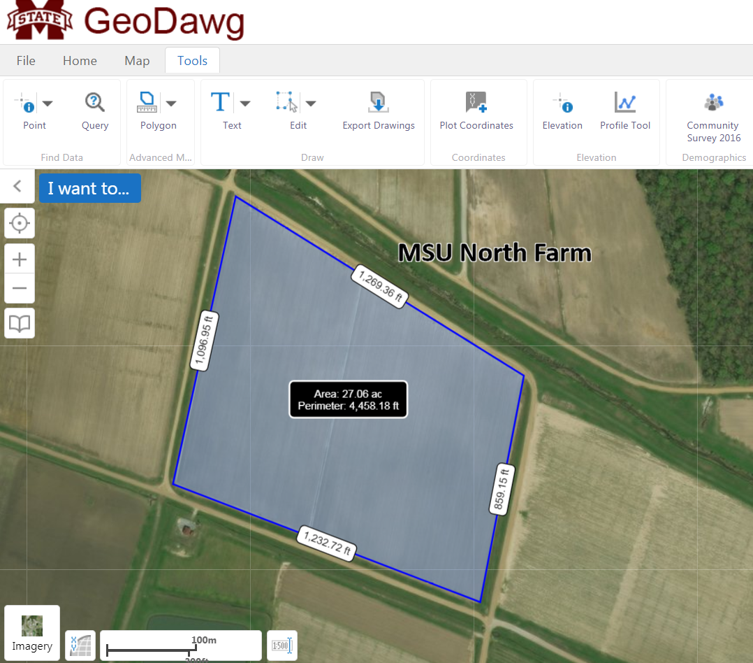
GeoDawg was developed as an online GIS with a relatively short learning curve.
GeoDawg contains several capabilities, such as generate linear and area measurements, display data from several layers listed in the Layer Catalog, generate thematic maps from the 2016 Community Survey, import/export data from/to the users computer and search for geospatial data on the Internet.
GeoDawg may be accessed through
http://geoproject.hpc.msstate.edu/GeoDawg/. For additional information about
GeoDawg, contact Randall McMillen at 662-325-4585 or
randall@gri.msstate.edu.
GeoExtension
An enhancement to
GeoDawg,
GeoExtension was developed for the MSU Extension Service personnel in the 82 county extension service offices.
GeoExtension provides users with the option to save map edits to the GEO Project server and share data with other
GeoExtension users. Project files may be created to save work in progress and to restore the project state by uploading the project file. For additional information about
GeoExtension, contact John Cartwright at 662-325-5447 or
johnc@gri.msstate.edu.
GeoCoast
Storm surges and sea-level rise are realities for those living on the Mississippi Gulf Coast, one of the largest concentration of population in the state. The web-based application,
GeoCoast, was developed for local and state decision-makers, as well as the coastal residents, to examine the impact of rising water on the coastal infrastructure. The resources found at
GeoCoast allow one to: graphically display sea-level rise (1 to 15 feet), assess sea-level rise on the routing of traffic, identify facilities listed in the EPA's Toxic Release Inventory located in inundated areas and find surface elevation at a user-specified point.
GeoCoast may be accessed through
http://geoproject.hpc.msstate.edu/GeoCoast/. For additional information about
GeoCoast, contact Gunnar Olson at 228-668-3420 or
gunnar@gri.msstate.edu.
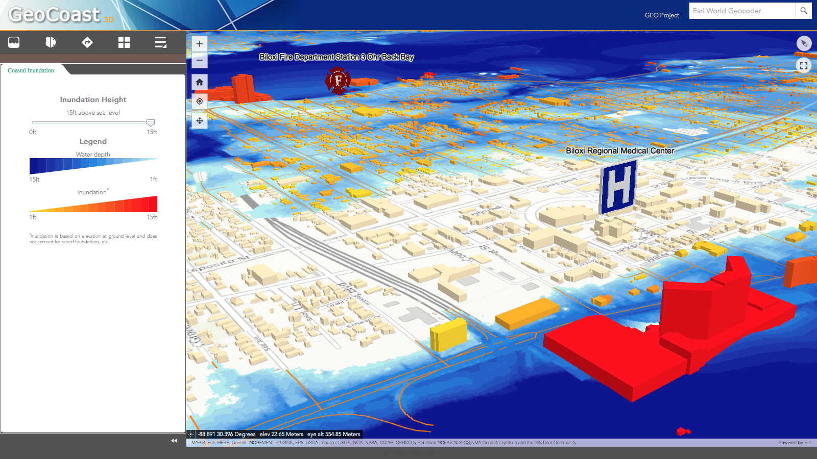
GeoCoast3D provides a 3-dimensional view of coastal inundation and the impact on buildings in the affected areas. A color coding scheme is used to display water depth and the number of feet at ground level a building is under water.
GeoCoast3D may be accessed through
http://geoproject.hpc.msstate.edu/GeoCoast3D/. For additional information about
GeoCoast3D, contact John Vander Zwaag at 662-325-2579 or
vanderz@gri.msstate.edu.

